|
|
|
 |
|
Estierra can be used in a
variety of ways. |
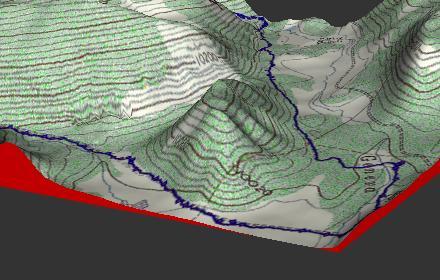
| Recreation.
Outdoor enthusiast such as hikers, mountain climbers, cave explorers,
horse back riders, skiers and mountain bike riders can use Estierra to
plan routes and to familiarize themselves with the terrain. The image to
the right shows a topographic map of the mountains west of Denver
Colorado overlaid on the terrain. The track of a mountain bike trail has
been superimposed on the map. This makes it easy to see the what parts
of the route may be steep and allows you to plan accordingly. |
 |
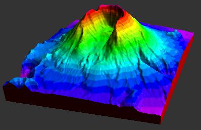
| Earth Science.
Geologist, hydrologists, and other earth scientist can use Estierra to
analyze the origin and formation of various surface features. For
example, Estierra's ability to view the terrain from any angle and
create sun-shadows from any direction allows you see very subtle
variations in the terrain. This makes it easy to see glacial remnants,
river terraces, fault scarps, lava flows and other features that are
virtually invisible on topographic maps and aerial photos. You can also
create 3D geological maps that give a clear picture of how rock
formations relate terrain features. |
 |
| Engineering. Estierra
can be used by civil engineers for planning roads, bridges, parks and
buildings. The ability to overlay various kinds of maps on the terrain
allows you to take into consideration the locations of existing
improvements and how they relate to hills, streams and other surface
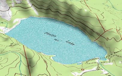
features. Land Management.
Estierra can be used by to locate wet lands, estuaries, and other
environmentally sensitive features. It can also be used to locate flood
planes, avalanche course and other dangerous land features. |
 |
|
|
|
|