|
|
|
Choosing
Sections/Surveys. |
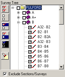
| B. Choosing Sections/Surveys.
If your finished SVG map only contains certain sections, surveys
or shots from the
cave, you want to selectively enable only those surveys. For example,
for this tutorial, I will be focusing on the B-Survey in Fulford Cave. |
| On the left side of the program you will see a
list of all the Sections, Surveys and Shots in the cave.
You can expand a section or survey by clicking on
the small [+] symbol to the left. This will display all the
surveys it contains. Each Section,
Survey and Shot has a small "check box" to the left. Clicking on the
checkbox enables that survey. |
|
| The pattern of
shots, surveys and sections you have selected can be saved to
file. This makes it easy to restore a previous pattern of
settings. If you have saved, a setting for this map, you should
load it now. (Refer to the SVG Exporter help files for more
information on these options.) |
| To enable the ability to include or exclude surveys,
check the "Exclude Sections/Surveys" box at the bottom of the
list. When you do this, only the surveys that are checked will
be displayed. In this tutorial, we only want to export the
B-Survey, so only the the B-Survey checkbox has been enabled.
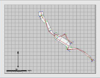
The image to the right shows the map with only the B-Survey
displayed.
|
|
|
|
|
|

