Declinations are used to compensate for variations in the Earth's magnetic field and to correct compass readings so they reference True North as opposed to Magnetic North. If you have entered declinations with each survey, Compass can use them to correct the cave plot to True North.
There are several different options that control the way Compass uses declination. They are selected by the choosing one of the options that appear in the Declinations box in the Settings Dialog |
|
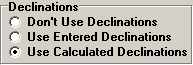
1. Don't use Declinations. This option disables the use of declinations entirely. Calculations are done entirely from the Compass, Tape and Inclination measurements and any Declinations entered in the survey header are ignored. This has the effect of orienting the map to magnetic north at the time each survey was carried out. This option is rarely used. The only situation where you might want to use it is when you want a map reference to magnetic north.
2. Use Entered Declinations. This option enables the use of Declinations in the compilation and loop closing process. If the option is enabled, the program adds declinations to every compass measurement before a shot is processed. This has the effect of orienting the cave to true north. This is the default setting when Compass is first installed on the computer.
3. Use Calculated Declinations. This option causes the Compiler and Loop Closer to ignore the declinations entered for each survey and calculates new declinations based on the date of surveys and the cave location. This is useful if no declination have been entered for the cave. It is also useful for finding incorrect declination values. If the loop errors improve dramatically after setting this option, it is a sign that one or more declinations are incorrect.
If no Base Location is location is set, the program will not calculate new declination. Since only Project Files can have a Base Location, you can only use this option with a project. If an individual survey has an invalid date, the program will not calculate the declination and will use the declination value entered in the survey data.
These settings can be saved so become the default value when the program first runs by choosing the "Options -> Save User Settings" item from the menu bar.