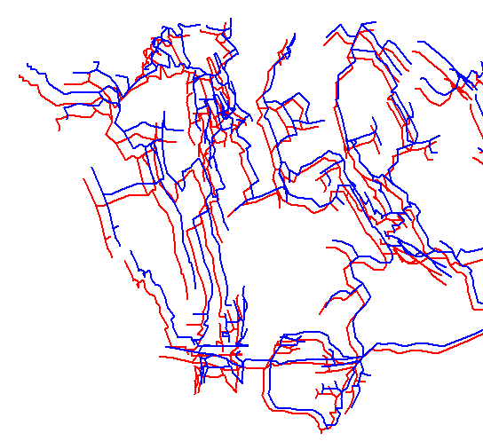
This option allows you to load additional files into the Viewer on top of the base file. This allows you to do things like compare different versions of a cave survey. For example, you could make close and unclosed PLT files of a cave and then compare them. You could also load a different cave as the auxiliary file. For example, here is an image showing closed and unclosed versions of Groaning Cave.
Warning: the files must be using the same coordinate system which would generally be UTM or Longitude/Latitude. They also must be near each other. If they are more than a few miles/Kms apart, Compass will need to zoom out so far to show an overview, that the caves will be invisible unless you zoom in dozens of times.
Before you can load auxiliary files, have to load a base file in the normal way. Once the base file has been load, select the "File->Auxiliary Files" option from the menu bar. This will bring up the Auxiliary Files Dialog Box.
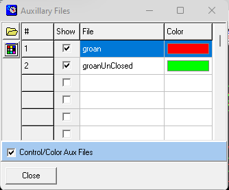
The dialog allows you to load and control Auxiliary files. Here are all the options:
|
This button allows you to load any Compass plot file (*.plt) as a secondary file. The file will be displayed along with the primary file. |
|
This button allows you to change the color of the selected file in the list. |
|
The check box next to each item in the list controls whether the corresponding file is displayed |
|
This checkbox enables the display and coloring of Auxiliary files. |