The File Properties Editor is activated by highlighting a particular Survey Data Items and executing either the Insert Existing File In Project or Edit File Property operations. The Property Editor allows you to insert or change a Survey Data File for a particular item in the tree. It also allows you to enter linking information, fixed station and the geographic location of the cave.
The File Property Editor has two pages. Each one performs a different set of operations. Here is a complete description:
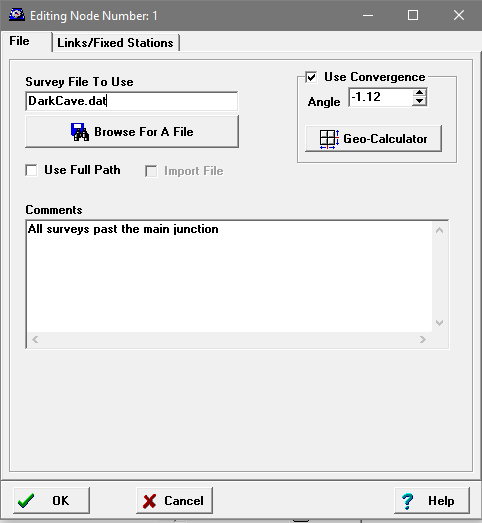
1. File Page. The File Page allows you to work with the files associated with a node. From File Page, you can change the survey name, control the path used by the file, import the file from a different directory and add comments
Here is detailed information about operations that you can perform:
|
|
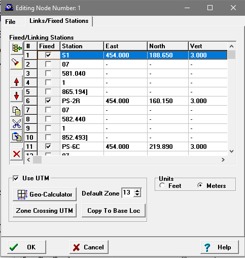
2. Links Page. Links have two purposes in Compass. The first is to set a station's location to a fixed coordinate. The second is to link together surveys that have duplicate station names. Here is a detailed description of working with links:
Link Page Layout
|
|