|
How Estierra Works
|
|
DEM Files. Estierra works by reading Digital Elevation Model files
(DEM) and converting them into three-dimensional models of the earth's surface.
DEM files contain a grid of numbers that represent the elevations of points
on the earth.
|
| Meshes. |
|
|
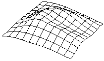
Estierra takes the points from a DEM file and converts
them into a series of rectangles called a "mesh." The mesh shows the shape
of the land surface. |
| Shading/ Highlighting. |
|
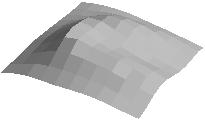
| The face of each rectangle is then filled
in with a solid color and shaded according to how the light would reflect
off the surface. This gives the surface a three-dimensional appearance, with
shadows conforming to direction the "sun." By moving the "sun" you can produce
different patterns of shadow that can reveal hidden detail. |
| Smoothing. |
|
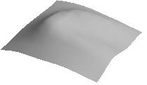
| Finally, the mesh is smoothed to give it a more natural
appearance. Once the mesh has been smoothed, it can be colored, highlighted
and overlaid in a variety of ways. |
| Coloring. |
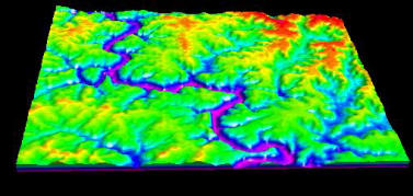 |
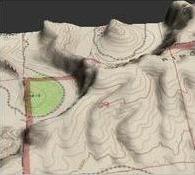
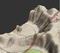
| The surface of the mesh can be colored and highlighted
in a variety of ways to make it easier to see terrain features. For example,
the mesh can be colored by depth to make easier to see altitude-related
information. You can also color by the steepness of the slope. This makes
it easy to see slopes that are like to avalanche or slide. It also allows
you find watercourses and wet lands that might not be visible by other methods. |
|
Overlays. |
|
|
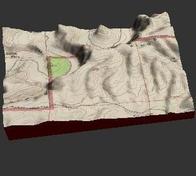
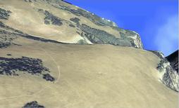
The mesh can also be overlaid with any image, such as
a topographic map, geological map or aerial photograph. The image is stretched,
like a rubber sheet, to conform to the terrain. This gives it an extremely
realistic representation of the topography |
|
Animations. The terrain image can be manipulated in real-time
using the mouse and tool bar buttons. On fast a computer you can rotate,
pan and zoom the image at a rate of hundreds of frames per second. You can
even fly over and through the terrain using an inexpensive joystick. Finally,
you save your "flights" over the terrain as an Windows movie file (AVI). |
|
|