| Export Tools |
| It is often very useful to export
cave data to other programs such as drawing programs, editors, CAD
programs and GIS. These program often have specialized tools that can
display or analyze cave data in ways that Compass cannot. For this
reason, Compass has several export tools that can be used to export cave
data in different formats. |
| 3D Exporter |
| The 3D Exporter is a
tool that is used to export 2D and 3D information about caves and
cave passages to other programs. Currently there three export file
options: Shapefiles, VRML files and DXF files: |
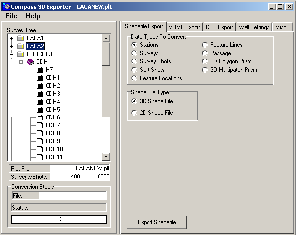 |
| Shapefiles. The image above show the
Shapefile page of the 3D Exporter. Shapefiles are GIS files designed
to be read and imported by ESRI programs such ArcView and ArcMap.
They can also be read by many other GIS programs.
Click here for futher information about
ESRI programs and the company's support for cavers. |
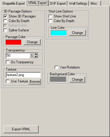
| VRML. VRML stands
for Virtual Reality Modeling Language and it is used to
display 3D images and models on the internet. The advantage
of VRML is that you can display the images on virtually any
computer that has a browser. The images can be on the
internet or just in file on a computer. Many people use VRML
files to display models of group cave projects on the
internet. The image to the right
shows the VRML export options. They include passage
transparency, animations, texturing, coloring by depth and
spline surfaces.
For detailed information about VRML,
including live 3D images of small and medium sized caves,
click here. |
 |
|
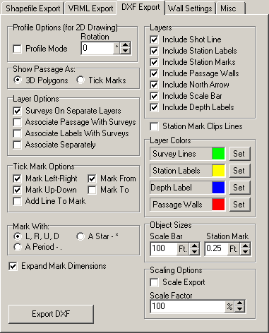
| DXF. DXF files
were invented for importing data into Autocad, one of the
most widely used and popular Computer Aided Design Porgrams
(CAD). Today DXF fiels are a widely used standard that is
supported by virtuall all CAD programs and many drawing
programs, including Corel Draw.
The image to the right shows the DXF export page and all the
options. Setting these options controls the data the is
exported into the DXF file. The options include Layers,
Labeling, 3D Modeling, a Scale Bar, scaling and a North
Arrow. There are also special modes to handle programs that
don't fully support the DXF standard. |
 |
|
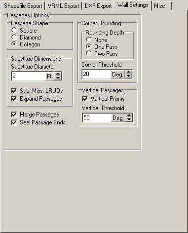
| Passage Wall Exports.
Compass uses a special 3D Passage Modeling engine to
generate solid 3D models of cave passages. These models can
be exported to all the different files format supported by
the 3D Exporter. The page to the right shows all the
options. |
 |
|
| Custom Exporter |
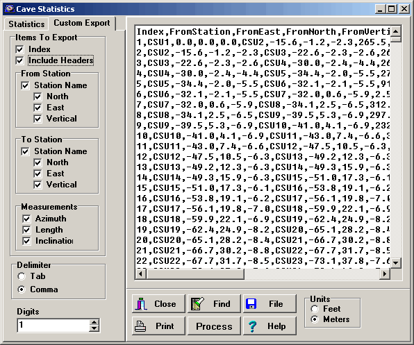 |
| Custom Exporter. The Custom Exporter is a general purpose
export tool that is designed to export various kinds of cave data to
databases and spreadsheets. You have control over which items are
exported including From Station, To Station, the Cartesian
coordinates for each station and the Azimuth, Length and Inclination
for each shot. Fields can be comma delimited or tab delimited. |

