|
COMPASS For
Windows |
|
|
|
Getting COMPASS
|
|
|
|
Download/Install Issues
|
|
|
|
Registration
Information |
|
|
|
Auxiliary Tools/Information |
|
|
|
Tutorials - (New) |
|
|
| Links |
|
|
|
Documents/White Papers |
|
|
|
COMPASS For DOS |
|
|
|
MISC. |
|
|
|
|
|
|
|
| TERRAIN MODELING
|
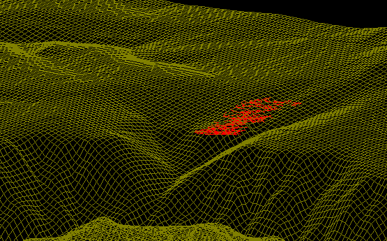
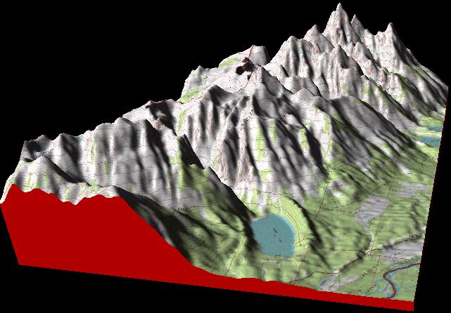
| Compass has the ability to create terrain models of the survey above a cave
and display them in the Viewer. The terrain models can be entered manually
or read from Digital Elevation Model files available for the USGS. With a
7.5 minute quadrangle, you can get very high levels of resolution. Here
is a 7.5 minute model of the terrain around Groaning Cave |
 |
| Building Terrain
Models |
| To build a
terrain mode, the Compass DEM Reader loads a Digital Elevation
Model file into memory that contains thousands of elevation
points that describe the terrain in a particular area. The
image to the below shows an overview of the terrain contained in
a DEM file. |
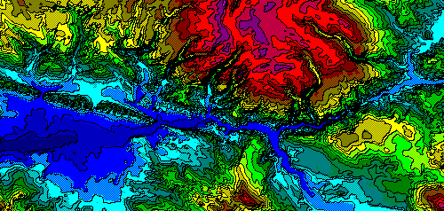
| In this case,
the image shows the terrain using the "Color-By-Elevation" mode
This image is a segment of the White River Plateau north of
Glenwood Springs, Colorado. The deep blue valley running across
the bottom of the image is the Colorado River. |
 |
| This image shows
the shaded relief mode. The image looks like a black and white
aerial photograph. It is another view of the White River Plateau
north of Glenwood Springs, Colorado. .Again, the deep
valley running across the bottom of the |
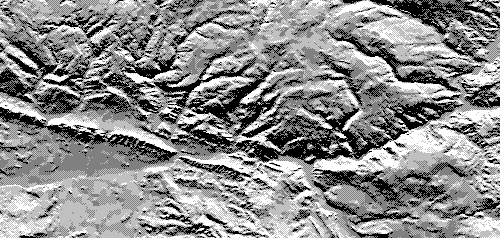 |
| image is the Colorado River.
You can see the river cutting through the "Grand Hogback" on the
lower left. These two images are used to select the terrain that
you will attach to the cave. |
|
 |
| Once you selected a portion
of the terrain to use with your cave surveys, the terrain is
attached to a plot file and can then be displayed in the Compass
Viewer. The image above
demonstrates the capabilities of the DEM Reader program. It is an image of
about 50 square miles of the White River Plateau from the southeast. To give
you idea of the scale, if you are viewing this on a 15 inch monitor one inch
equals one mile.
To the right is Deep Creek Canyon. Groaning cave is barely visible beneath
the grid lines the hills to the west. With the Windows or DOS viewer, you
can pan, zoom and rotate the image in such a way that you can literally fly
down the canyon and over the ridges. With the new movies features, you feel
like you are riding in a flight simulator. |
|
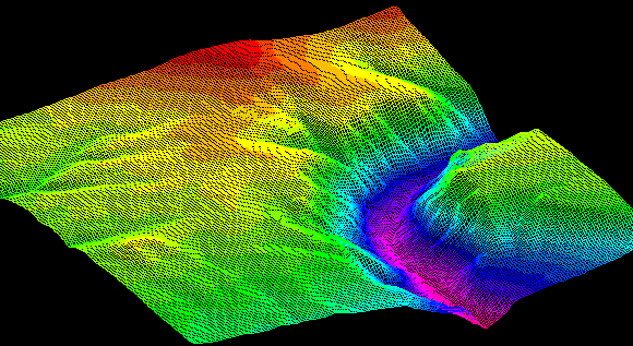
| Estierra - Terrain Modeling Program |
 |
|
Estierra
Terrain Model of the Grand Teton Mounts
|
|
Compass has new adjunct program
called Estierra. Estierra
is a program for modeling the terrain of
the earth. It reads standard USGS
Digital Elevation Model files (DEM’s)
and converts them into three-dimensional
models of the earth’s surface. These
models can be colored, shaded,
highlighted and overlaid with
topographic maps or aerial photographs.
This creates extremely realistic 3D
images of the terrain. In addition,
Estierra uses Microsoft’s DirectX
technology that gives it the
ability to do high-speed animations of
the terrains. This means the terrains
can be zoomed, panned and rotated in
real-time. You can
even fly over and through the terrain
using a joystick or mouse. Go to the
Estierra Web Page for complete
information. |
|
Free To Registered
Compass Users |
|
If you are a
registered user of Compass, you are
automatically registered for Estierra.
Also comes on the
Compass CD-Rom Package |
 |
|
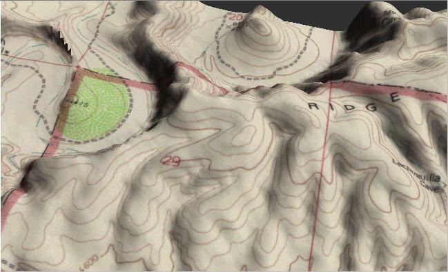
Here is a model of the
terrain around Lechuguilla Cave with a
topographic map overlaying the surface.
The canyon to the northwest is the
Serpentine Bends. The cave appears along
the lower right edge of the image.
Terrains can be overlaid with geologic
maps and aerial photographs with equally
stunning effect. |
|
|
|
|
| Sponsored Links |
|
|
| Sponsored Links |
|
|
| Sponsored
Links |
|
|
| Sponsored Links |
|
|
|

