Compass Cave Survey Software Logo - Bats, Compass and Night Sky
Custom Search
 
 Sponsored Links


COMPASS For Windows
Compass Tour
Other New Features
Cartography Tools
Live 3D Cave Images
On-line Help (New)
Written Description
Revision History: 99-21
Testimonial Letters
Contact Author
Getting COMPASS
Getting Compass
Compass On A CD.
Download/Install Issues
Installation Instructions
Antivirus Issues
Authenticating Files
False Positives
Registration Information
Credit Card Reg.
Reg. Info/Forms
Printable Reg. Form
3rd Party Reg. Form
Auxiliary Tools/Information
Cave Data
3D Glasses
ESRI/ArcView Tools
Tutorials - (New)
Inkscape Tips and Tricks
Radio Locations
Magnetic Anomalies
Installing Under Win8
Compass on Mac/Linux
Google Earth Overlay
Declination/Convergence
Cartography Tools
Sketch Editor.
SVG Export
Inkscape SVG Maps
Illustrator SVG Maps
SVG Round Tripping
Adopting SVG Maps
Complex Plot Tutorials
Trouble Shoot CaveX
Exporting HPGL
Canvas Digital Map 
ArcView/ESRI
Italian Tutorial
Using the Compass CD
DEM Tutorial
Links
Cave Related Links
User's Pages
User's Group
User Questions
Documents/White Papers
Compass File Formats
ArcView/ESRI
Finding Blunders
Finding Loops
Loop Closure
Least Squares Papers
Least Squares Issues
Passage Modeling
Survey Blunders
J. Halleck- On Loops
History/Philosophy
SEF File Format (1992)
About The Author
COMPASS For DOS
DOS Compass Demos
DOS Compass Features
Magazine Review
MISC.
Betas
Other Products


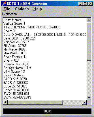
SDTSCon. SDTSCon converts SDTS DEM files back to the original DEM format. The "Spatial Data Transfer Standard" (SDTS) is a new government data standard for transfering various kinds of mapping and terrain data. The new standard is more complicated and convoluted than the original standard, and so, in some ways it is less useful. For example, a typical SDTS DEM file can require 18 files, where as the same data in the original format only requires one. For this reason, many programs only support the original format.

SDTSCon has several features that are unavailable in other converters:
ERROR DETECTION. Many DEM and SDTS files have internal errors that make them unreadable, unusable or distorted. SDTSCon can detect and correct many common format errors, making the files usable inspite of the errors. This can be very useful, because in many instances, error free versions of the files are unavailable

ANALYSIS. SDTSCon displays a detailed analysis of the contents of the SDTS file. This allows you to see problems in the file that can effect the accuracy and usability of the elevation model.

SPEED. SDTSCon is four times faster than other similar programs.
 

Getting A Copy.  SDTSCon. Is freeware. You can download an copy of SDTSCon by clicking here.

 
 Sponsored Links
Sponsored Links
 Sponsored Links
 Sponsored Links

<< Home

Custom Search